 MapToNap
Drop a pin.
Get the whole site.
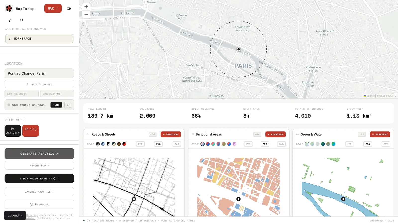
One click reads the real city and draws 38 site analyses as editable vectors. The model on this page is built in your browser from the same data.
Every layer
of the site.
Streets, land use, green and water, noise, massing: each one a separate, editable drawing, all registered to the same point.
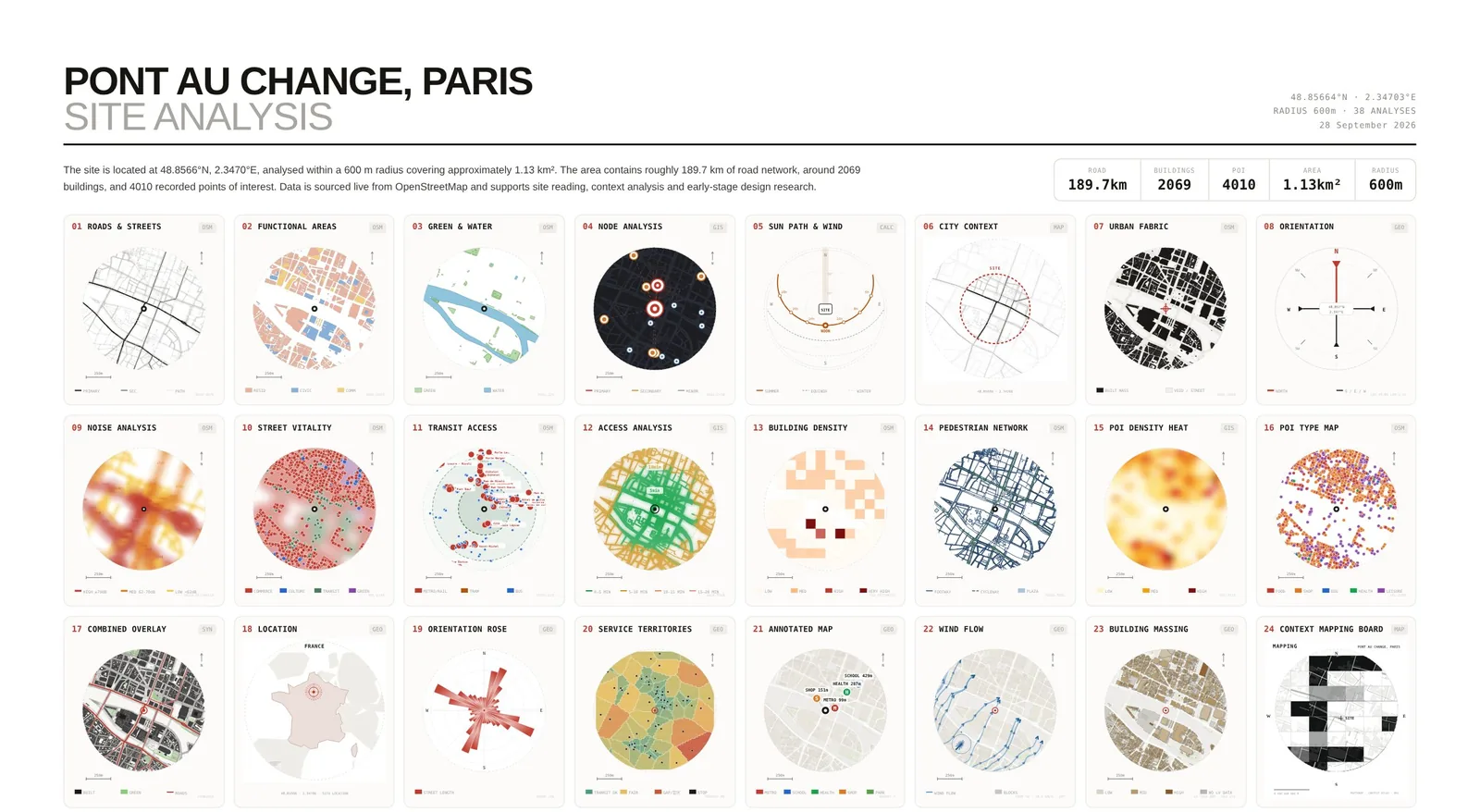
38 ways
to read a site.
Every tile is a real export. 35 read Pont au Change, Paris, at the same point and scale; the 3 terrain studies read the valley around Fallingwater, Pennsylvania, because central Paris is too flat and built-up for them.
one pin
 Roads & Streets
 Functional Areas
 Green & Water
 Node Analysis
 Sun Path & Wind
 City Context
 Urban Fabric
 Orientation
 Noise Analysis
 Street Vitality
 Transit Access
 Access Analysis
 Building Density
 Pedestrian Network
 POI Density Heat
 POI Type Map
 Combined Overlay
 Location
 Orientation Rose
 Service Territories
 Annotated Map
 Wind Flow
 Building Massing
 Context Mapping Board
 Urban Data · Nodes
 Urban Data · Grid
 Temperature Year
 Precipitation Year
 Annual Climate
 Daylight Hours
 Solar Radiation
 Topography
 Slope & Drainage
 Terrain Wireframe
 Building Typology
 Isometric Massing
 Sound Sources
 Walk Accessibility
Try it on your site→
Walk Accessibility
Try it on your site→
One project.
Twelve tools.
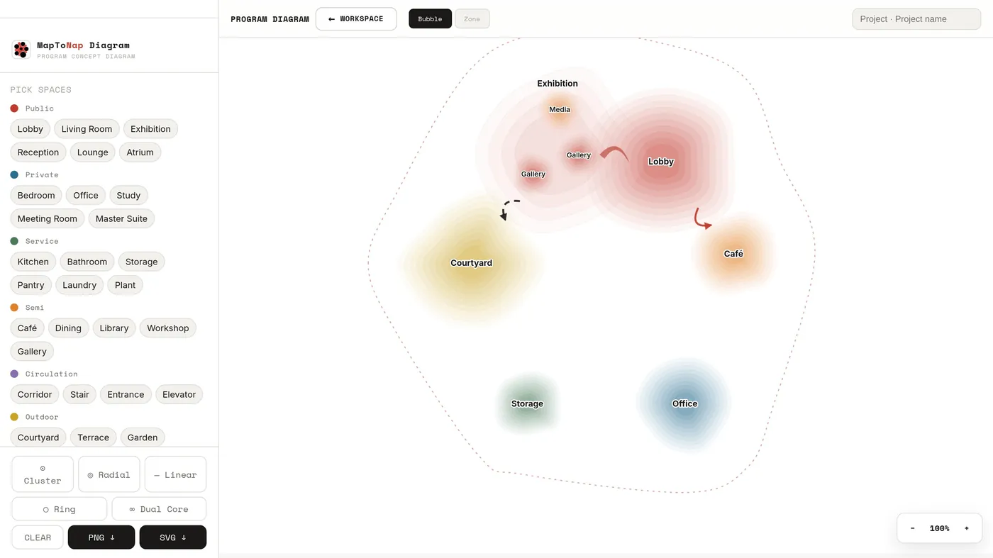
Analysis is the start. Max opens the whole studio: concept, strategy, flow and bubble diagrams, masterplan, plans, elevations and the final board. Every screen here is the real app.
Pay for the project,
not forever.
A 30-day pass covers a studio deadline. Nothing renews by itself; we send a reminder three days before it ends.
Pro
- All 38 analyses, no watermark
- Editable SVG, vector PDF, A3 report
- Colour themes and custom legends
Max Most chosen
- Everything in Pro + 3D city
- Concept, strategy, flow and bubble diagrams
- Masterplan, floor plan, elevation, parti
- Portfolio boards and layered axon
Lifetime Best value
- Everything in Max, no expiry
- Every future tool and analysis
- One payment, restore on any device
- Invite rewards: a 7-day Max pass per friend
Give 20%.
Get 7 days.
Every paid plan comes with a personal code. A friend saves 20% on any plan; you get 7 more days for every friend who buys. Lifetime members get a 7-day Max pass to give away instead.
Your own purchases do not count. Old invite links from the previous rewards program no longer apply.
No prompts.
All control.
Is this an AI image generator?
No. Every drawing is built from maps, open data and editable geometry, so you can change the composition, colours and relationships yourself. The 3D model at the top of this page is made the same way.
What happens after 30 days?
The pass ends by itself. Nothing is charged again, and we email you three days before. Your projects stay in your browser and the four free analyses keep working. Buy another pass or switch to Lifetime whenever you need it.
I bought before passes existed. Do I lose anything?
No. Every purchase made before 30-day passes stays permanent, exactly as you bought it.
Can I use the drawings commercially?
Yes. Every paid plan includes commercial use for your own projects, clients and publications. Keep the OpenStreetMap attribution on map-based drawings.
Studio or school licences and invoices?
Write to [email protected] with the number of seats and your billing details. We reply with a quote and an invoice.
What can I export?
PNG, editable SVG and vector PDF, plus an A3 report of every analysis. The floor plan tool also exports DXF.
Where is my work saved?
In this browser. Export a project backup before clearing browser data or moving to another device; your purchase restores anywhere with your code.
Do I need to install anything?
No. MapToNap runs in any modern browser. A laptop gives you the most room for drawing and editing.
From map
to nap.
38 drawings and one A3 board before midnight. Then close the laptop.